Jo and I were up in good time on
Thursday 23rd March. With Jo having sorted my washing and
dropping the boys off at school well before classes started, we
headed back to Honey stocking up on provisions on the way. Ian and
Rhonda had already arrived at the marina and they set to work to help
me get away on time – Ian taking my jerry cans and gas bottles to
be filled and Rhonda and Jo packing down my paddle board, filling up
the tanks and changing the working gib for the genoa, whilst I stowed
washing and provisions and finished readying Honey. Although I am
sailing solo, I have been lucky to have a lot of people support me in
making it happen! After hugs and farewells Honey and I left the
marina just before 11am, making our exit out of the harbour before
the strength of the incoming tide set in. It was a lovely afternoon
of sailing, with 15 knots of westerly that gradually eased to about
10 knots as I passed Motiti Island and the Astrolabe Reef. There are
buoys marking out a section of water around the Astrolabe, presumably
marking the site of the Rena wreck. As I passed the reef a helicopter
flew out of the west and hovered over Honey for a couple of minutes,
most likely taking a break from the monotony of what was proving to
be a fruitless search for the lost skipper of the little speed boat.
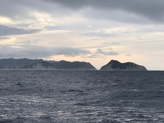
 |
| White Island in the far distance, with a plume of smoke |
 |
| Sunset with approach of the front |
The forecast was for a change to 15
knots of NE that evening before it was expected to switch back to the
NW in the morning, and I headed Honey in a north easterly direction
to ensure I was well north of White Island before the wind change.
The front came through just before sunset with winds from the ENE
picking up to 20 knots with sloppy seas – cruising into head winds
again, arghh! With winds with a larger easterly component than I
would have liked and on a tight reach from port, I was almost making
a beeline for the Volkner Rocks. I started Honey's engine to keep my
heading up and by midnight I had passed about 2 miles north of
Volkner Rocks. Although it was a dark night, I could make out the
columns of rock stretching ominously out of the water, followed soon
after by the sillouette of White Island. By 1.30am I had put a safe
distance of water between Honey and White Island heading towards Cape
Runaway, although by then seasickness had kicked in – the only time
I had been sick since my sail to Taranaki. The 0533 forecast came
through and had changed – now predicting SE 25 knots with rough sea
in Portland for the following day when I would be sailing down the
east coast. (It had been previously forecast to be 15 knots of
easterly, and the change surprised me as I could see no evidence of
it on the weather map). However the east coast is not a pleasant
place to be in strong SE winds and there is nowhere to hide, and
given I was already seasick I made the decision to sit the weather
out and shelter in the Bay of Plenty. The forecast for the Bay of
Plenty was still for a change to the north west, and there are few
places to shelter from a northwest in the eastern part of the bay. I
made for Omaio Bay, which is roughly half way between Opotoki and
Cape Runaway, about 4 hours sail in the wrong direction. It looked to
offer protection from the north west as well as all easterly and
southerly sector winds, and I tucked in behind Motunui Island in
heavy drizzle just before midday. After some food and water (which I
kept down) and a nap I felt ready to move on. The forecast for
Portland was back to 15 knots of easterly for Saturday – perhaps
one of the Metservice meteorologists had earlier made an error. I
tidied up Honey and decided to have a good rest before an early start
the following morning. As I was hopping into my bunk shortly after
sunset the winds shifted to the west, the only direction that the bay
could offer me no protection – putting out a bit more scope on the
anchor and setting the anchor alarm, I resolved to sleep as best I
could until the alarm sounded.
Despite a slightly sloppy night on
anchor I slept well, and it was the alarm on my phone that woke me
(not the anchor alarm), and Honey and I were on our way by 4am. The
winds were light and following and it was not long before dawn
arrived. Making good time, we rounded Cape Runaway entering the
Portland sea area - it was a beautiful bright morning and with the
tide also running in our favour, we covered the miles. The winds
gradually died out and we motored from Lottin Point, passing Matakaoa
Point at the northern end of Hicks Bay at about 1pm. The forecast
easterly came through shortly after, and it was a long motor sail on
the wind with the tide now against us, covering the stretch towards East Cape. A large pod of
dolphins helped pass the time. They sometimes disappeared when I
popped down into the cabin, but when I came back on deck and called
to let them know I was there, they returned to their acrobatics and
bow wake riding around Honey. It was great to have the company, and
they stuck with us until we were due north of East Island!
 |
| Rounding Cape Runaway |
 |
| Hicks Bay |
 |
| The northern coast of East Cape |
In my passage plan I had planned to
pass East Cape before sunset, and just before 6pm I passed south
through the latitude of East Cape, on the outside of East Island. I
had passed solo around my fourth and last cape that marked the outer
corner of New Zealand!! This felt more special than the previous
three – my journey east was over and now I only needed to head
south south west for a couple of hundred miles or so and I would have
completed my circumnavigation! I jumped a jig in the cockpit and then
settled down for a beer to celebrate.
 |
| East Cape rounded! |
Night fell quickly and the winds picked
up, veering to the ENE. I pulled in a reef, and then a second and a
third, and my speed held a steady 6-7 knots, as a I passed the
twinkling lights in the bays down the east coast. By midnight I had
passed Tokomaru Bay and two hours later I was offshore of Tolaga Bay.
It was a lovely sail and I was surprised at how fast Honey was moving
as it didn't seem too windy or choppy. We altered course to pass
inside of the Ariel Bank, and I lay down for a few 20 minute stints
with my alarm sounding when I needed to check on our course. I woke
up with a start just after 7am with daylight entering the cabin –
in my sleepy haze I hadn't set the alarm properly and had slept for
more than an hour! We were less than 5 miles from the entrance to
Poverty Bay where there was more heavy sea traffic, lucky I woke up when I did.
In the light I could see the winds were almost 25 knots and I had a
3m following swell with a 2m cross swell – very lumpy seas –
Honey was riding them so well I hadn't realised what we were sailing
through. The winds died out as we turned into Poverty Bay, and we
motored the last distance into the bay and along the channel towards
the breakwater, mooring up in the inner Kaiti Basin just after 10am.
 |
| The marina in Kaiti Basin |
Kaiti Basin forms part of the mouth of
the Turanganui River, with a breakwater splitting it and the rest of
the commercial harbour from the river. There were another couple on
their fishing boat moored alongside – they had just completed a 3
month circumnavigation of New Zealand the day before, and we traded
stories of our adventures! Talk also turned to the weather, and the
unpredicability of the winds – the locals do not pay much heed to
the Metservice forecasts, as the Portland sea area covers such a
large area of coastline and the forecasts generally do not correlate
well to the winds in and around Gisborne. After a shower at the
Tatapouri Sports Fishing Club and a nap, I had a wander along the
road back down towards the harbour entrance, past where timber was
being loaded onto ships, and onto the Cook Monument, marking the spot
where Cook first landed in New Zealand in 1769. This first landing
was accompanied by skirmishes between the crew and the local Maori,
and Cook left unable to to restock on provisions hence naming it
Poverty Bay. After dinner at the fishing club, I turned into bed
early to ensure I was refreshed before sailing the next short hop
down to Napier.
 |
| Cook Monument |


No comments:
Post a Comment