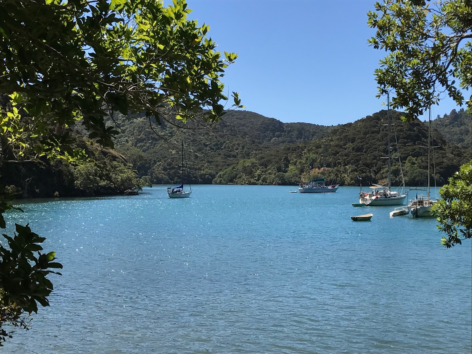
Honey

Honey

Sailing around New Zealand

Emily is sailing solo around New Zealand on her 32 foot yacht Honey, from Lyttelton south down the east coast, around the bottom of Stewart Island, up the west coast of the South and North Islands and down the east coast back to Lyttelton. The whole adventure is expected to take 3 months. This blog will provide updates as I travel (when I have mobile reception to upload).


Monday, 13 March 2017

Tutukaka and the Poor Knights (20th - 24th February)

I was due to meet up with family friends, Mike and Jane, for an early dinner at the local eatery, Schnappa Rock when I arrived into Tutukaka. Needless to say this was a somewhat later dinner, and so fantastic to catch up with Mike and Jane. They have a large property in the hills behind Tutukaka, of almost entirely re-generated native bush and moved there 17 years ago with a vision to support kiwis and other rare native birds to re-establish themselves in their natural habitat. Mike and Jane have worked relentlessly with their conservation effort over the years and now have several kiwi pairs in addition to pateke (brown teal) and other rare birds breeding on their property, aided by significant trapping of stoats, feral cats, rats and possums, and the construction of a small lake designed to support the ducks. Mike and Jane are also instrumental in supporting the wider effort of kiwi conservation along the Kiwi Coast in Northland. I had never been to their property and was keen to see it, and they invited me up the following morning for breakfast.

Another beautiful day followed, and I was picked up by Mike and Jane in the morning and taken up for a yummy breakfast of pancakes and fruit followed by a mini tour of their property. The bush was so lush, it was incredible that this extent of regeneration had taken place in only 17 years, and they have fantastic views across the hills and out to the sea and the Poor Knights islands. Mike had completed a beautifully crafted kayak from oregon timbers last winter, and it hadn't yet seen the water – we had decided at dinner the previous evening that there was no better time than now, and the kayak was duly taken out from indoors and mounted on the roof rack. Mike and Jane then gave me a tour of the local area – down to Wooley's Bay, Whale Bay and Matapouri. The grand launching of the kayak (or initial trial, there may be some pressure from local friends for an official launching on another date) was at Matapouri Estuary, and she proved as beautiful in the water as out – all three of us having a go, we found she glided perfectly through the water. Mike and Jane also tried out the paddle board, and then we headed off for icecreams and a swim at Whale Bay, a stunning and popular bay with the locals, being a west-facing white sandy beach. To round off a perfect day, we stopped in at the pizzeria for dinner that evening, had a drive through Ngunguru and I was treated to a bath at Mike and Jane's before being dropped back to Honey.
 
Mike and Jane and the kayak!
The next day, 22nd February, was similarly a beautiful hot and sunny day, and I was intending to move out of the marina and carry on exploring the coast. There was no-one coming into the berth Honey was occupying so I did not need to leave in the morning, and I joined Mike and Jane as they tracked two kiwis, Milo and Kicker, that had recently been released into their new habitat. The kiwis are fitted with transponders, and we were able to track the area they were now occupying. Kiwi pairs typically live in an area of 10 hectares, being very territorial birds, although this sometimes reduces to only 2 hectares. Obviously approaching the birds directly is not permitted, but we were able to confirm the valleys that both kiwis were tucked up in for the day.

I had decided I would move out to Whale Bay that afternoon, and over a coffee Mike and Jane said they were keen to come along for the short trip so they could see what was involved in sailing solo. After readying Honey and topping up both fuel and water we headed out of Tutukaka Harbour. With the wind died down to only 10 knots this was not nearly as exciting as entering the harbour two days previously. Although there was still a reasonable swell running, of about 1.5m, making for an uncomfortable passage, which unfortunately did not sit well with Jane's stomach. To minimise the wallowing in the swells, we motor sailed on to Whale Bay and dropped anchor, and Jane was only to happy to jump into the water and swim ashore (although she did appreciate coming for the ride). I was keen to visit the Poor Knights and Mike was keen to come to – fantastic, this meant I would have my own guide as well someone to assist with helming! Jane was very happy to sit this out – so we made plans for Mike to join me the next morning and we would leave from and return to Whale Bay.
 
Beautiful Whale Bay
 
There was a bit of a surge in Whale Bay and I was not entirely comfortable with where I was anchored, although I was away from the rocks either side of the entrance to the bay and it was held firmly. During the night the light winds moved and combined with the surge, Honey dragged her anchor, the first time I had had this problem on this trip. I was able to reset the anchor without pullling it up and relaying it, although I was close to the rocks so set my alarm to recheck my position regularly for the remainder of the night.

Just before 7am the next morning, Mike arrived, swimming out to Honey and pushing his boogie board with backpack filled with a packed lunch and clothes on top! And we upped anchor and set sail for the Poor Knights Islands, heading first to Rikoriko Cave. The Poor Knights are about 13 miles off the coast and we had gentle SE winds and motor sailed towards the islands. As the winds picked up a little, we were able to sail at 4-5 knots, arriving into sheltered Marori Bay just before the majority of the commercial diving and sight-seeing boats transporting visiting tourists. The waters around the Poor Knights are deep, with risk of anchors becoming fouled, so we did not stop and drop anchor, but nosed around the edges of the bay and past Rikoriko Cave, peering into the depths in search of the fish life. Although a lovely sunny day, it was slightly cooler, and neither of us were drawn to jump into the water for a snorkel, particularly as by this stage at least six commercial boats were anchored in the bay.
 
Mike and his transport out to Honey

Rikoriko Cave

Mike, Honey and I set off around the south side of Aorangi Island to view the arches that pass from one side to the other of two small off-lying islands, called the Southern Arch and The Tunnel Arch. These are spectacular holes through the rock, presumably hollowed out by the sea over several millenia. Mike told me how a Maori community previously lived on the island. The Poor Knights are now a marine and nature reserve, and the terrain is very steep, the cliffs rising high above the water as well as dropping down to the depths. It certainly seemed incredible that anyone could inhabit the islands given how rugged, harsh and exposed they are and the difficulties with landing a boat. The landing point for the community was on the southern side of Aorangi, close to Southern Arch, Archway Island, which was a marginally less steep part of the island. With the winds from the SE, which during my stay in Northland has been the predominant wind direction, the sea was more rough around the south western corner of the island and we chose to pass outside both Archway and Aorangaia Islands, then sailing up the western side of both of the main islands. There were a number of other arches visible on Tawhiti Rahi Island, the northern island, and we paused outside one in Maomao Bay at the north east corner while we had our packed lunch. We then motored down the sheltered east side of the islands, back to Marori Bay, completing our circumnavigation of the Poor Knights Islands! When we headed back to the North Island, the winds had died down and we motor sailed to Whale Bay. After a great day, I bid Mike farewell as he hopped back in the water with his boogie board and pack bound for the shore. I had dropped anchor a little further out so there was less surge and fortunately no issues with the anchor dragging that night.
 
The Tunnel Arch
 
The beautiful Poor Knights
Arch on Tawhiti Rahi Island


The next morning, 24th February, it was time to set sail back to the Bay of Islands to meet Tim who was flying into Kerikeri the next day. I raised the mainsail and weighed anchor shortly after 10am and motor sailed out to Elizabeth Reef. It was a sunny day with very light winds, of only about 5 knots, a typical Northland day, so Honey and I kept motor sailing up the coast. The winds finally quickly picked up to a little over 15 knots from the SE when we were abeam of Whangamumu and it was a lovely short sail around Cape Brett, passing this time inside of Piercy Island, and into the Bay of Islands. Honey and I made for Oke Bay, a lovely sheltered bay south of Urupukapuka Island with a white sandy bach, dropping anchor soon after 5pm.

Thursday, 9 March 2017

Cruising Around Northland (13th - 20th February)

With the winds blowing at 25 knots from the northwest, it was an ideal forecast for a quick afternoon sail down to the Bay of Islands. Once I was back on Honey, I stowed away the dinghy and got ready to sail, moving on quickly as the tide was on its way out and I had dropped anchor close in to get Mum safely to shore. While I was in the harbour, I pulled up the main, putting in one reef for good measure, and motor sailed out beyond the entrance. The forecast was for rough seas, and there were a few large charter fishing boats outside of the harbour sheltering around Stephenson Island but no yachts. I unfurled the genoa, leaving some furled up to minimise the sail size, and sailed out towards Stephenson Island before altering course towards the north end of Flat Island and north of the Cavalli Islands. It was beautiful weather – a sunny warm day with a fresh breeze blowing and a bit of a sea, just the stuff that Honey is made for! We had a lovely time, Honey averaging about 7 knots from Stephenson Island to north of the Cavallis, maximum speed I noticed on the GPS was 10.6 knots!! The Cavalli Passage has a least depth of 2.3m, and with a low spring tide when I was due to pass, coupled with rough seas and a 1-2 m swell, I needed to pass around the outside of the islands. Once I was clear of Taheke Rock, we veered down towards the Needles and Cape Wiwiki and Ninepin Island at the entrance to the Bay of Islands. The winds dropped off as I sailed into the Bay of Islands, making for Urupukapuka Island and I dropped anchor in sheltered Otiao Bay. It had taken less than 5 hours to sail from Whangaroa.

                                          Passing north of the Cavalli Islands

                                          Approach into the Bay of Islands

The forecast for the following day, 14th February, was for rain, so I made a booking for a berth at Opua Marina for that night – also a chance to shower, do the laundry and top up Honey's water while I waited for the rain to pass. But the rain didn't come – so Honey and I spent the day nosing into a few of the bays on Urupukapuka Island, and I stitched up the zip on the dodger (to connnect the rain shelter between the dodger and bimini, that had been torn off at Port Hardy) in preparation for the rain. Then it was a nice gentle sail towards Opua, via Te Rawhiti Inlet, with the wind easing off and dying as I passed Waitangi and Russell. By the time I arrived in Opua, the marina office was shut as was the laundry. But fortunately Owen and Emma from Dulcinea, one of the neighbouring yachts, popped over to say hello, helped me tie up Honey, filled me in on what and where everything was in the marina, and lent me their gate card so I could access the marina shower. Owen and Emma saw I was flying the Pelorus Boating Club pennant – they are also members of Pelorus Boating Club, also from Christchurch and had recently returned from sailing in the Pacific. While in Opua, we sorted out Tim's booking to come up and visit me – he's flying into the Bay of Islands towards the end of February! So I decided I would head further south beforehand and then return to the Bay of Islands so we can explore it together.

One thing I was keen to do while I was in the Bay of Islands was to visit Kerikeri – then I could get to a supermarket to re-provision and see the movie “Lion”. Chris was involved in the production of the movie, I had read and loved the book and I was keen to see Lion while it was still on the big screen. But Kerikeri is some distance from the water and many miles from the closest marina, although it is possible to get to Kerikeri Basin by sailing through Kerikeri Inlet and up the river, and tying up only a few kilometres from the town centre. There are private pole moorings up the river and some of the owners will accommodate boats that venture upstream. The river is however very shallow, only 0.1m depth on the chart in some places (this is the height at the lowest astronomical tide), so with Honey drawing approximately 1.8m (and the tidal range of 1.65m) I would need to make my way there right on the top of the tide. High tide was 11.35am so no time for doing my laundry, I needed to be in the Pickmere Channel in Kerikeri Inlet, the access to the river, no later than 11am to be entering on a rising tide.

Honey and I left Opua at 9am and motored towards Kerikeri Inlet – it was a very calm morning, with heavy rain on the forecast for later that day. We made good timing, passing through Kent Passage on the west side of Moturoa Island, and on into Kerikeri Inlet. Light rain started setting in, and I was only in the start of the Pickmere Channel when my depth alarm started (this alarm beeps whenever there is less than 0.5m of water below Honey's keel). The alarm beeped on and off the whole way into Kerikeri Basin, sometimes showing 0.0m under the keel, which was a bit disconcerting. I had found that occasionally the depth gauge didn't read correctly, so I hoped that was the case although there were a couple of moments when I thought I could feel Honey touching the mud bottom. Pickmere Channel is well marked, but from the Kerikeri Junction where there is a fork – one way through Waipapa Stream and the other up the Kerikeri River – there were few port and starboard markers. We made it up right to the historic Stone Store in the heart of the Kerikeri Basin without getting stuck – whew! The river was a little deeper in the basin, and there were several yachts moored nearby, so I took up a pole mooring in front of one large yacht and close to the wharf. It didn't show quite enough depth, but I figured given the large yacht behind that perhaps the depth gauge was not reading correctly and in any case it would probably be ok if Honey settled slightly into the mud in the river. The rain started pouring down so I was pleased I had done my stitching to zip up the rain shelter. There has been a drought in Northland so many would have been pleased to see the rain, although I couldn't help wish that it was falling in Christchurch where the Port Hills fire was by now raging out of control.
 
                                          The Stone Store, Kerikeri Basin

In the mid afternoon I headed to shore in the inflatable, and as I left I noticed that Honey had a very low waterline, perhaps she was sitting on the bottom. The Stone Store was open, the oldest standing stone building in New Zealand, and I popped in to have a look. It had previously operated as a post office and all-goods store, and now displays and sells all sorts of old Kiwiana goods, and even has a genuine old-time smell about it, a great place to poke around in! When I came out about half an hour later, Honey had certainly grounded herself with a clear list towards the starboard side. There was still almost 2 hours left until the bottom of the tide, so she wasn't in the best spot. But there was nothing I could do about that now, and with all the skin fittings on the port side and wash boards in (so no concern about flooding), there was nothing I could do. I left Honey and walked on through the rain into Kerikeri to watch Lion – it is a fantastic film and great to take my mind off Honey who would have carried on tilting in my absence (although I didn't quite relax into the film for half an hour until low tide had passed). After the film, a quick bite to eat and re-provisioning, I returned to Honey – she was back floating with no sign of her previous grounding. It was pitch dark and still raining heavily by this time, and I decided the best option would be to stay put rather than try to exit the river and risk a worse grounding at night.

The next morning I woke as expected at about 5am, on the next ebbing tide with Honey grounded and again slightly tilting onto her starboard side. As I lay there, Honey carried tilting, bit by bit – not a very comfortable feeling! Every little additional movement to starboard felt like a lot, and I even got up to tie a little plumb line onto the inside of the washboard so I could see that it wasn't as significant as it felt. Lying in my berth on the port side, suddenly 'boing!' and Honey righted herself settling back upright into the mud. The tide was still ebbing, and depending on where I moved Honey was starting to settle either starboard or port side – I moved myself to the starboard side so she would settle that way as before and read my book to distract me – a much better feeling as the tide started to come back in and Honey re-righted herself! A couple of hours later and a knock on Honey's hull, one of the locals, Keith came to tell me that this pole berth was very shallow and had caught a number of boaties out – he advised the wharf alongside the Stone Store has plenty of water if I was staying longer. I was keen to get underway, not just to escape being grounded but to head further south. I extracted some of Keith's local knowledge to ensure I didn't stray into the shallow parts of the river – generally staying close to the boats and the pole berths is best. (I also thought that means I am close to a pole if I did end up grounding and needed to winch Honey out!) At 11am I headed off with the last of the rising tide and cleared out of the Kerikeri Basin without any further hitch.

Next stop was the Kerikeri Cruising Club where I finally did my laundry. My plan for the afternoon was to head to Whangamumu, a few miles south of Cape Brett, although I knew I would be running short of daylight – Deep Water Cove still in the Bay of Islands and a few miles before Cape Brett was my back-up plan. Heading out from Doves Bay, I made directly for Cape Brett, skirting around Slains Castle and the Brothers. The wind in the bay was a steady 15-18 knot northerly breeze and with full sail, Honey moved along nicely at 5.5 knots. It was still lightly raining and there was a swell of about 1.5 m running – I hadn't deflated and stowed my inflatable dinghy which was trailing along behind, so I decided to make for DeepWater Cove. My back-up autohelm also gave up working at this point, clearly not happy with getting wet, and I hadn't yet attempted to resurrect the main autohelm, so I was back on the tiller. When I arrived into Deep Water Cove, which as it name suggests has deep water, there were already two other yachts anchored. I wasn't happy with my proximity to one of the other yachts anchored and wanted to be sure I slept well after my previous unsettled night of grounding, and it was on my third set of the anchor and in rather deep water with all the anchor chain out that I was comfortable that I would not need to get up in the night to check on the anchor. Honey does not have an electric windlass, so after I had manually hauled in the anchor and 40m of anchor chain twice, my dinner certainly hit the spot and I did sleep soundly that night.
 
                                          Deep Water Cover - with Honey anchored out deep

The 17th February dawned with rather heavy rain which eased mid morning. Before stowing the inflatable I went ashore and followed the DOC walking track up the hill that heads towards Cape Brett. There was significant bush cover and I only got small glimpses back towards the Bay of Islands and down the east coast in the direction I was going to be sailing. By the time I got back to the water, the rain had cleared, clouds lifted and the sun was drying out Honey – time to set sail for Whangamumu. The winds were very light and I raised the main sail and motored out towards Cape Brett and the Hole in the Rock, passing outside of Piercy Island so I could take in the view. There were quite a few other boats out, and Honey and I motor sailed close to the coastline with its steep cliffs. About a mile south of Cape Brett, I cut the engine and with the headsail raised we slowly sailed towards Whangamumu with a very light following breeze. The breeze falled away completely and we motored into the inner part of Whangamumu Harbour and dropped anchor. It was now a beautiful hot and sunny day. I had planned to stop only briefly in Whangamumu before heading south to Whangaruru but it seemed to lovely to rush away. I paddle boarded to shore where there are remains of an old whaling station, with photographs displaying how the station appeared in its heyday. It always amazes me how quickly the bush takes over with the large old boiler, wharf blocks and concrete vats being the only part of the whaling station that were still largely intact. I spent the rest of the afternoon relaxing on Honey, swimming, paddle boarding and following some of the stingrays (they are quite incredible how with one ripple of their wings they can scoot away at great speed when I get too close) and walking around some of the tracks. I caught up with the sailor from the neighbouring yacht from the previous night in Deep Water Cove (who said he had been quite comfortable about where I was anchored on my first set), and we noted a pohutukawa tree that had fallen over and resprouted roots half way up the tree. Almost every beach in Northland is lined with pohutukawas, incredibly beautiful and resilient that seem to be able to reach their roots to find the smallest amount of soil to grow into such large trees.
 
                                         Piercy Island (Hole in the Rock) and the Dog
Beautiful Whangamumu Harbour
The next day I headed off late in the morning to Whangaruru Harbour, less than ten miles south of Whangamumu. It was another lovely sunny and relatively calm day with only a few knots of breeze from the east, and I alternated between motor sailing and slowly sailing/drifting towards the harbour. The wind picked up as we rounded Pararaunui Point into Whangaruru, and I anchored Honey offshore from Teparapara Bay on the east side of the harbour, and after doing a few jobs on Honey I spent the rest of the afternoon stretched out in the sun reading my book!

The following morning, Sunday 19th February, was slightly drizzling to start but this soon burned off into another beautiful day. I had sailed past Bland Bay the previous day, and was keen to see what it looked like from the other perspective, from land. There is a narrow isthmus that separates Whangaruru from Bland Bay, and I paddle boarded down the harbour to Tuparehuia Bay and walked through the motor camp to the beautiful beach of Bland Bay on the other side. A group from the Navy had set up camp for two weeks of training, they certainly get to stay in some lovely spots! After I had paddled back to Honey and had a quick swim, I was keen to see if I could resurrect either or preferably both of the autohelms. I'd opened up my back up autohelm to ensure it was fully dried out the day before and I put this back together, and checked over the connections for the main autohelm. The main autohelm controller was working again, so quite possibly it was a voltage issue I had encountered on the trip north, but the drive was now not working properly. I upped anchor and motor sailed out towards Mimiwhangata Bay, about 5 miles out from the harbour in the south eastern corner of Whangaruru Bay, so that I could test out the autohelms while we were on the move. Unfortunately neither worked adequately – the main autohelm drive would turn to port but would not turn to starboard (later I found that the drive's motor had burnt out), and the back up autohelm would not operate on automatic mode. This meant I would be sitting at the tiller until I could resolve the problem – which is fine for short distances, but not ideal for overnight passages.

After I dropped anchor in Mimiwhangata, the chap from the neighbouring boat, Rose of Therese, came over to say hello and invite me to dinner with his partner. They introduced themselves as Ian and Marcia, and we had stayed at several of the same anchorages – Whangamumu two nights previously, I had spoken to Ian briefly at Deep Water Cove, and we had been moored in the same bay in Whangaroa Harbour. They were curious about my story sailing solo, and we spent the evening trading stories and talking about some of the fantastic places we have visited. Ian and Marcia are both very keen to visit Dusky Sound, which is still my absolute favourite place, and they were dead jealous of my trip there, but they have also spent time in Anchorage, Alaska, a place on my bucket list.

I had contemplated sailing to Great Barrier Island the following day, but had been advised that if there was any southerly component in the forecast 20 knot easterly winds then it would be too tight on the nose to be able to sail. The forecast had seesawed between south-east and easterly winds, and being at least 60 miles distant it would be a long day to reach the island even if the winds were favourable. Plus I would only have a day or two there before I would need to sail back up to the Bay of Islands to meet Tim. I decided to instead head the short distance down to Tutukaka, a wise decision given the winds did in fact blow from the south east, such that it was almost too tight on the nose to sail to Tutukaka. I left Mimiwhangata just after 1pm, expecting to be tucked up in Tutukaka less than 15 miles south soon after 3.30pm. There was a reasonable 2m swell running and a rather messy sea, with the swell coming from both the south east and north east. And with the wind at about 15 knots from the ESE it made for a slow and bumpy sail south. The wind gradually picked up to 20-25 knots and veered to the SE, and I reefed in the sails so Honey sat better. Whilst the wind strength was helping to drive Honey, the wind direction was not idea, and it was almost 6pm by the time I was outside of Tutukaka Harbour. This was my first time entering into Tutukaka Harbour (actually my second time I later found out, having been here aged 3 ½) and I had not realised what a hair-raising approach it is. The entrance is 0.1 mile wide between Tutukaka Head and Red Rocks, with the remainder of the approach all rocks. With the swell building to about 3m in the shallow waters at the entrance, more than 20 knots of easterly wind and the sun lowering to the west in the direction I was heading, all I could make out was a wall of white water where the entrance should be. I contemplated making for what was shown on the chart as the entrance or turning back to find another anchorage, but decided to wait for another boat to enter and follow them through, now motoring and circling Honey out beyond the harbour entrance. Another yacht was approaching so I did not need to wait long, and followed them through avoiding all the rocks. Needless to say it was a nerve racking entrance – real brown underpants stuff – and I had a swig of whiskey once Honey was tied up safely in a berth in the marina!

Monday, 20 February 2017

Time with Mum in Whangaroa (9th - 13th February)

The forecast gale winds were a non-event. I heard the front hit in the early hours of the morning but there was more rain than wind, not even warranting getting up to check on Honey. It may have been stronger outside the harbour but Whangaroa is very sheltered. With a heavy drizzle settled in for most of the day, I spent the time catching up on odd jobs around the boat, tidying up and I finally got the inflatable out from storage ready for Mum to arrive.

Soon after 6pm Mum arrived into Whangaroa! I had moved Honey so she was anchored off of Whangaroa township and took the inflatable ashore when she pulled up. Mum was super keen to do some fishing while she was here, and we headed into the sport fishing club and got some tips on where to go to catch snapper, the main advice being the best time to catch is at the change of light – dawn and dusk. We went for a short walk, and a short drive to Kaio in search of bait, and back to the fishing club for dinner before heading back to Honey for the night.

We'd had no luck with finding anywhere open in the evening so had no bait, and in the morning we headed back into Kaio to stock up on food and bait. After a leisurely breakfast we then headed out of the harbour nosing into some of the stunning bays on our way. It was flat calm in the harbour but as we headed out the wind was still blowing 15-20 knots outside of the heads – so we raised the sails and headed for Stephenson Island, anchoring on the north west side in the lee of the wind, close to Cone Island. Another yacht was anchored in the bay and they were fishing, so after we'd had our lunch we pulled up anchor and drifted around the rocks and Mum fished. With the wind dying out and the afternoon moving on, we headed back into Whangaroa Harbour for a brief dinner before dusk – then it was time for more fishing at the heads. We lost the light very quickly and it was dark when we came back into the harbour and anchored in Ranfurly Bay, just inside the entrance.

The next day, Saturday, was a fantastic day – a little mist when we woke up, early to catch the dawn fishing, but otherwise it was shaping up to be a lovely sunny day. A little after 6.30am we had lifted anchor and were headed back to the harbour entrance – along with half of Whangaroa – there were small and large fishing boats, blokes crammed into tin dinghys, all working in a line motoring slowly between Kingfish Point and South Head with their fishing rods out – it was quite a sight and experience. We moved in with Honey, the only yacht, and followed suit, Mum with her rod out, and me working to dodge the other boats and their long lines trailing behind. We saw others catching fish – some kingfish, and I saw one snapper being hauled in – and Mum carried on with her run of catching snapper. With the day lightening, the boats gradually disappeared, as we did too when the bait had run out, anchoring back off Whangaroa township.

We had breakfast anchored outside Whangaroa township, accompanied with live music – a very talented man was strumming his guitar and singing on the water's edge, the sound carrying across perfectly with the calm morning. Once the local shop had opened and we had restocked up on bait, an ice-cream and more tips on how to catch the big fish (as it turned out the fishermen this morning were all fishing for kingfish, we weren't in the best place for snapper so probably were the source of some amusement to those who saw us!), we headed back out on Honey, out of the harbour and east towards the Cavalli Islands. The wind picked up and we had a lovely sail past Flat Island and onto the northern Cavallis, anchoring in a calm little nook on the south side of Panaki Island. After relaxing in the gorgeous sunshine, we went ashore onto Panaki Island, in search of a walk to the top that was noted in the cruising guide. I have a copy of the Royal Akarana Yacht Club – Coastal Cruising Handbook, Millenium Edition, so it was printed some 17 years ago. There was no sign of any walk, perhaps long overgrown, and we didn't feel like bushwacking in our jandals, so we motored in the dinghy across to the north side of Motukawanui Island (Big Cavalli), about 2/3 of a mile distant where we could see there was a walk. It was a beautiful sandy beach, and we pulled the dinghy up and walked along the track, a mowed walking strip stretching up the hill. The views were fantastic at the top – it was such a clear sunny day, and the views stretched from Cape Karikari through to Bay of Islands, we thought as far as Cape Brett. Once we'd motored back to the dinghy, we nosed Honey through the small passage between Big Cavalli and Haraweka Island to try some more fishing, not staying long due to the discomfort from the swell, and we motored back past Panaki Island to Hamaruru Island, a relatively sheltered spot more comfortable for fishing. Mum caught more snapper, her tally now at 28, mine at 0, but then I put down the line and caught a decent sized trevalli. The sun was starting to lower in the sky, the days being notably shorter up in the far north than in the South Island, and we sailed Honey back towards Whangaparoa Harbour. The wind died down as we approached Flat Island with the setting sun, and with the full moon raising from the sea behind us, we motored back into the harbour. We dropped anchor in Waitepipi Bay, among of a city of lights from all the boats moored around us, filleted the trevalli and fell soundly asleep – a wonderful full day out on the water!
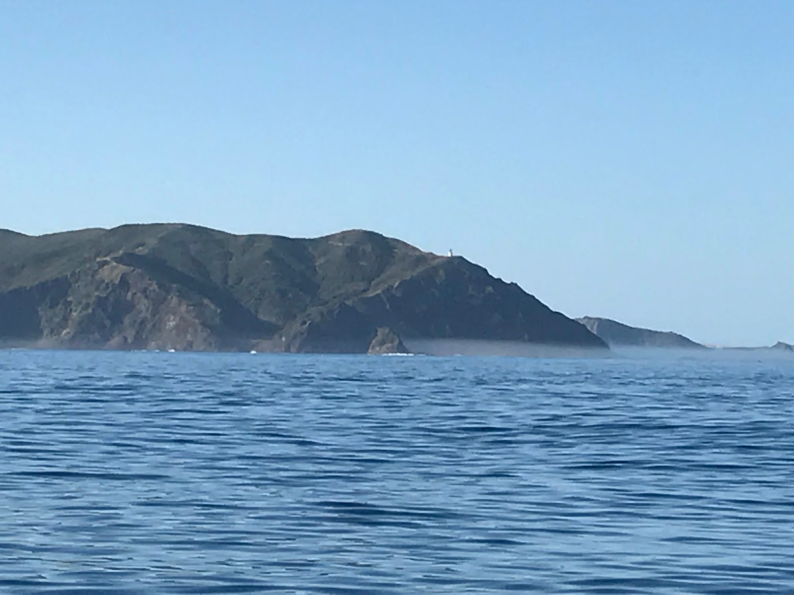
                                          Mum on Panaki Island, with Honey anchored in the bay and Big Cavalli behind
                                          The northern Cavallis, Honey anchored in the bay off the right hand island
                                          View towards Flat Island, Stephenson Island behind and Cape Karikari in the far distance
                                          View towards the Bay of Islands

We had a relaxing start on Sunday morning, having decided we'd done enough fishing for now, choosing instead to stay put on Honey, reading and taking note of some of the large boats including a superyacht from Bikini, Marshall Islands in the bay, named Triton, we figured a statement on the nuclear testing done by the Americans which has rendered Bikini uninhabitable. Late in the morning some light drizzle set in and we stayed put until the middle of the afternoon, after we'd had our delicious homemade fish and chips and the drizzle had lifted, nosing out of Whangaroa Harbour and then back into Lanes Cove in Ruru Bay. We went ashore for a stretch of the legs, seeing that this cove like many others we have been to, is noted as a 'Kiwi Zone', and there are many stoat traps that have been set. I wasn't sure if I would know a kiwi call if I heard one, and we found DoC recordings of both female and male North Island kiwi on line – I had heard a distinct and different bird call on my first night in Whangaroa which I hadn't been able to place, which now I am sure was the female kiwi.

The next day Mum and I set off in the morning, back to shore and on the walking track up to the Duke's Nose (or the Pope's Nose as we had been incorrectly referring to!) This is a lovely short and rather steep walk to the top of the prominent rock feature behind Lanes Cove – with magnificent views down to the boats below, around the harbour and beyond. Access to the very top of the Duke's Nose is via a steep rock face with a rope secured to its face. After I scrambled up and down, we walked back to Honey and headed back into Whangaroa township, the dinghy trailing behind as it had since I had picked up Mum. It was rather gusty, with the weather that day a north west of 25 knots, and the dinghy flipped in a gust – whilst annoying, especially retrieving the seat that had fallen out, at least this was a reminder that I would need to stow the dinghy before I left for the Bay of Islands. Unfortunately it was time for Mum to leave – I had not been sucessful in persuading her to stay on – and we made it ashore in the dinghy through the gusts and whitecaps, with both Mum and her pack dry. One last icecream at the store and I waved Mum good-bye as she drove back to the airport and I headed back out to Honey.
 
                                          Climbing down the rock face at the Duke's Nose
                                          View from the Duke's Nose - looking east
                                          View from the Duke's Nose into Waitepipi Bay

Sunday, 12 February 2017

Lazy Summer in the Far North (1st - 8th February)

After a brief sleep, I had a shower (solar shower, raising it up off the deck with a spare halyard) cracked open a can of beer and cooked up some dinner and felt much refreshed. I sat and reflected on my journey over the last four days. Lots of people ask what it's like to be out on the ocean surrounded by the sea and beyond sight of land, do I get bored? Well, I never get bored. When the weather is fair, I have heaps of time to think. And when I am out there mostly I am present to how small and insignificant I am, not even a speck on this great blue planet of ours. And vulnerable and exposed – the sea was calm and benign on my trip north, but it can change and with little notice, and if I fell overboard it wouldn't matter how calm it was, I would be a goner. So a healthy respect for the sea is so important. I also feel very privileged and lucky to be out on a part of the world that few people see, and seeing our beautiful coastline from an angle that only boaties can see.

Thoughts like this make me wonder how humans can be so naive to be wreaking so much damage to our beautiful planet – mostly led from corporate rooms and government offices, with the natural world shut out. If only some of these corporates and politicians could get out and experience the wonder and beauty of nature as I am, then perhaps they may treat our world with the respect and nurturing it deserves.

The next day, the first day of February and my first to explore the north eastern coast, I rested until late in the morning, catching up on lost sleep and waiting for the north west winds forecast to pick up in the afternoon. A couple of other boats had anchored approx 500m outside from the cove the night before and they had moved on, back to their fishing grounds north of the North Coast. By 2pm it looked like the wind had set in, so I lifted anchor and sailed out of Otau Cove heading down towards Houhora Harbour. With a beam wind I was hoping for a nice 6 knot sail down Great Exhibition Bay. The wind was a moderate breeze and Honey moved nicely through the water until off Parengarenga Harbour, where the wind veered to the north and eased. By 5pm the winds had died completely and I kicked the engine into gear for about 40 minutes until the north west picked up again and Honey and I sailed into the entrance of Houhora Harbour. With the flood tide, there was a good favourable tide taking me into the harbour, and I dropped anchor shortly after sunset behind Tokoroa Island just beyond the harbour entrance.

On my second day in Northland, I made the most of the incoming tide to motor the short distance up Houhora Harbour to the wharf at Pukenui, and topped up with diesel – I had used a whole 40 L in my trip up from Taranaki, not bad I thought considering the light winds I'd had. A trip up to the Pukenui Four Square to grab what I needed, and I headed back out the harbour, the tide now outgoing and pushing me along. I find that I am often most tired the second day after a coastal passage, so I headed as far as Houhora Bay – a lovely bay with a sandy beach and dropped anchor, staying there for the rest of the day and the following. It was a chance to relax, recharge, get out my stand up paddle board and go for an explore, and give Honey a good tidy up. There were three other boats that stayed in the bay over that time – in sharp contrast to my time down in Fiordland, they kept to themselves, I barely got a wave out of them. I had anticipated that this would be the case sailing in these waters – so many people and so many boats, that there would be little novelty in seeing Honey and me, we're just another yacht and sailor.
 
                               Houhora Bay
 
On Saturday 4th February I headed out from Houhora Bay, motoring with flat calm weather again, towards Cape Karikari, taking my time to try a spot of fishing around the Moturoa Islands. There were quite a few other boats fishing in the area, but I had no luck, not even a bite – not sure if there were no fish there or perhaps they didn't like the left over gristle from my steak! Without a freezer aboard Honey I can't keep squid bait for very long. On the other side of Cape Karikari, I raised the sails and drifted slowly the short distance to Matai Bay, another place recommended by Chris and Tess who had been there two weeks earlier. Matai Bay is a beautiful spot, with two sandy coves, and was quite busy with the long Waitangi weekend. Time for more exploring on the paddle board, walks along the beach, swims and relaxing enjoying the hot and sunny weather.

                                          Honey in Matai Bay

Sunday was more of the same – hot and sunny with very little wind. I headed out under sail, drifting from Matai Bay on towards Doubtless Bay and Mangonui. Only a very short distance it still took a few hours, with only a few knots of wind and Honey doing a speed of 2-3 knots. The day breeze picked up as I approached Mangonui, so finally as I needed to drop sail our speed had picked up to 5-6 knots. After dropping anchor just inside the harbour, it was time to try out Mangonui's famous fish and chips – renowned to be the best in New Zealand. Having the stand up paddle board has been fantastic – I have not even needed to get Honey's dinghy into the water, so off I went paddle boarding into town to have my fish and chips! Persistance was needed, there was a power cut affecting the whole of Northland due to a scrub fire under the main transmission lines, so I waited almost 2 hours for those fish and chips – I can confirm they were very good and worth the wait!

                                          Mangonui Harbour - with fish and chip shop visible along shoreline

On Waitangi Day, I started out with a paddle board around the harbour, checking out the sights of Mangonui from the water. When I was at the floater outside the Mangonui Cruising Club, I saw large splashes in the middle of the harbour – perhaps a shark? Mangonui means “big shark”. To be safe, on my way back to Honey I hugged the shoreline and then crossed the harbour at its narrowest point – half way across a shark of about 3m length swam up to investigate, it looked harmless and didn't find me interesting enough to stick around. Sharks have been known to attack surfers mistaking them for seals, I hope that's not the same for stand up paddle boarders!

                                          Historic Mangonui

Doubtless Bay is known for its long sandy beaches, and when Honey and I left Mangonui that morning, we took advantage of the onshore breeze to pass along Coopers Beach, Cable Bay and Taipa Bay – all very populated bays, before heading north out of Doubtless Bay. It was another hot, sunny cloudless day up in Northland. The breeze gradually died out and by the time we reached Berghan Point, the eastern end of Doubtless Bay, the wind had died completely. On with the engine, and we motored onto Whangaroa Harbour.

                                          Cone Rock and interesting coastline on way to Whangaroa

Whangaroa is very interesting to approach from the north – it is a popular harbour and with the day drawing on several boats were heading back into the harbour. From the sea there is a great rock face, cliffs lining the coast,and from my angle of approach it looked as if boats were being swallowed up by the rock face as they disappeared into the harbour – the entrance, being only 0.15 miles wide was not visible until close up. We headed into the stunningly beautiful harbour, characterised by spectacular high rock formations, and dropped anchor in Waitepipi Bay where there were already dozens of boats. With large shallow and sheltered bays, it is possible to drop anchor almost anywhere in the harbour, and with a mud bottom it makes for good holding. Whangaroa is known as one of the safest harbours in New Zealand.

                                          Approach to Whangaroa Harbour

The next day I moved Honey to Lanes Cove in Rere Bay, just around the corner from Waitepipi, where I planned to have a quick look around and view of the waterfall before moving on up the harbour. Rere Bay was even more stunning, and I paddle boarded ashore and walked along one of the DOC tracks before I headed out on my paddle board in search of the waterfall. It was another hot sunny day with little wind. With the tide being high, a couple were also heading up in their inflatable dinghy in search of the waterfall, and as the river at the head of the bay got narrower and shallower I caught them up. We went as far as we could go, until the river was too shallow, and then meeting up with a walking track walked on leaving paddle board and dinghy by the river. The couple, Ian and Rhonda, had sailed up from Tauranga and were spending a month to sail back – their first reaction was that I was joking when I said I had sailed up from Lyttelton! We walked for about 40 minutes to the top of the saddle with no sign of any waterfall, and then back the way we came, enjoying a fresh water swim in a hole in the river above where we had left the dinghy and paddle board. We think that with the lack of any recent rain, that the waterfall had probably dried up. Ian and Rhonda have spent some time sailing around the waters that I am shortly heading to – the Bay of Islands, Great Barrier Island, Hauraki Gulf and Tauranga, and the places in between, and they invited me back to their boat that evening to share some of the great spots that I should visit. It was quite late when I left and long dark, so I headed back to Honey on my paddle board with head torch. I hadn't intended to stay the night in Lanes Cove, and had moored Honey a little too close to the shore for my liking – with the tide low she was less than a paddleboard length from the shore but still in deep enough water – but with the weather being dead calm and the tide turning, I decided to stay put for the night.

                                          Morning mist in Waitepipi Bay

                                         Approach to Rere Bay

                                          Lanes Cove in Rere Bay - Honey on left

The following day, Wednesday 8th, I decided to head out from Whangaroa and look around the area outside. Gale winds were forecast for that night, so I planned to be back tucked up in Whangaroa Harbour before they hit. And Mum was due to arrive tomorrow, to spend a few days with me, exploring Whangaroa, the Cavalli Islands and hopefully doing a spot of fishing – my plan is to meet her in Whangaroa township. There was a light breeze heading in towards Taupo Bay so I headed the other direction, into Whangaihe Bay, a deep cove only a couple of miles from Whangaroa Harbour. There were a couple of unoccupied baches and no other boats in the bay, so it was a lovely peaceful afternoon relaxing in the sun before Honey and I headed back to Whangaroa, mooring up in Waitapu Bay, just around the corner from Whangaroa township and noted as a good anchorage in SW and SE conditions – perfect for the gale winds forecast.

Tuesday, 7 February 2017

Up the West Coast and around the Capes (28th - 31st January)

It was a beautiful and calm morning on Saturday 28th January, which made for an easy exit from the pole berth, removing all my ropes as I went. There were several pleasure fishing boats heading out to make the most of the lovely day, and as I struck straight out from Taranaki motoring in a straight line for Cape Reinga for the first 10 miles I had company on the water – fishermen trolling alongside at the same speed as Honey.

As I cruised out from Taranaki, I reflected on the similarities with my departure from Milford Sound four years ago... Just like in Fiordland, the folk at Taranaki were so welcoming and seemed to bend over backwards to assist me – there were few yachties that stopped into Taranaki each year, normally when repairs were required. When I had arrived into Taranaki, I was told that the weather was uncharacteristically windy – 10 metre waves on the Sunday two days before I arrived which had washed a several hundred tonne wave buoy onto the rocky beack within the port (similarities with the fishermen in Stewart Island who had said the “weather was broken” when I arrived), and now as when I left Milford there was a large high forming and a forecast of settled weather with light southerlies to take me up the coast. And I also had a mountain to watch as it disappeared beyond the horizon – not Mitre Peak but Mt Egmont/Taranaki – I was 10 hours out of Taranaki before Mt Taranaki finally disappeared from view.
 
Motoring out from Taranaki

Three hours out from Taranaki and the forecast south west wind picked up to a pleasant 15 knots so I could switch off the engine and settle into a very pleasant day of sailing. With my intended straight line to Cape Reinga, I was going to be at least 50 miles off shore, which Maritime Radio had said would push the limits of their VHF coverage, so if needs be I would make my scheduled calls using the satellite phone. As I was heading out from Taranaki, I checked the distances if I altered my heading to stick to within 35 miles of land – it would take me only about 1-2 hours longer, and with guaranteed VHF coverage I would easily be able to make my scheduled calls and get weather updates, without costly calls via the sat phone. And so I altered my heading to due north.

I didn't see a single other boat on my first day after I had left the Taranaki fishermen behind, until close to sunset when I sailed into the vicinity of where a number of fishing boats were working – probably the fishing fleet from Kawhia or Raglan that were out tuna fishing. There were several lights of fishing boats around me with their anchor lights on, and the wind had died out completely so at 11pm I also turned in for a few hours sleep with my anchor light on. The fishing boats probably had their sea anchors out, but I left Honey to drift with mainsail flapping in the swell so I got out to check every hour to be sure I was not going to drift into any fishing boat. By 5am I decided to get on my way again, and with no wind I fired up the engine and carried on heading due north. The forecast had now eased to variable 10 knots, so I was concerned at this rate that it may be a motoring trip and I could run low on fuel.
 
Sunset, with a fishing boat just visible on the horizon

My second morning was a very pleasant one, albeit glassy calm as I motored up the west coast. As I approached offshore Manukau, I started picking up several of the calls on VHF channel 16. It was Auckland /Northland Anniversary weekend, and with beautiful weather there were obviously a lot of boats out and about around Auckland. Although I didn't see any being 20 miles offshore, Maritime Radio seemed to have a very busy day responding to multiple 'Mayday' and 'Panpan' calls.

By 12.30pm the wind started to fill in and I switched off the engine to settle into an afternoon of relaxed sailing. The wind gradually picked up to about 15 knots from the south west and the heads of Manukau which had been visible in the distance disappeared and more of the western coastline took its place. By 5pm I had closed to within 15 miles of the shoreline, and altered my course to 330 degrees (true) to follow the line of the coast. When the sun set I was directly off Kaipara Harbour, and the wide opening to the harbour was clearly visible out to sea. The winds eased after sunset but they didn't die out completely, so I was able to sail on through the night at about 4 knots, with the glow of Auckland disappearing behind me and the glow of Dargaville brightening to starboard. I had seen no boats or ships since I had left the fishing fleet behind after the previous night, so I was confident to stretch my sleeps out to 30 minutes in between popping my head up to check on my whereabouts and that no other boats were around. Around 4am my new (replacement) autohelm gave up working – I thought perhaps the battery voltage had dropped too low, so I started the engine and motor sailed for an hour. With the autohelm still not working I got out my trusty back-up, the ST1000, which was able to work easily in these calm conditions, cut the engine at 5am and sailed at about 3 knots in dying winds. The wind had completely died out by 7am, so I switched the engine back on and motored up the coast.

It was getting noticeably warmer each day as I headed north – Taranaki is at approx 39 degrees latitude and I had now passed 36 degrees latitude – and although the winds were from the same direction I had fewer layers on in the evenings and night. A lot of people have asked what I do when I'm out sailing for days on end. Unlike my sail from Port Hardy to Taranaki, this was an easy relaxed sail up the coast, so I had plenty of time on my hands – Honey did most of the work with me just checking and monitoring progress and sails as needed. I spent a lot of time reading, and for a whole day I didn't need to get up onto the deck to attend to anything (I am able to reef the main from the cockpit and with a furling headsail I can also operate this from the cockpit, but invariably something gets tangled necessitating getting out onto the deck). My world existed between Honey's cabin and cockpit, and the beautiful sea and sky views around. With the settled weather, came beautiful starry nights and the hint of a new moon that disappeared soon after sunset. The Milky Way and its clouds of stars were fully visible and I saw many shooting stars – when I was looking I could see these about every 5 minutes – just stunning! I didn't put out my fishing rod – in hindsight, I probably should have done this when I was close to the fishing fleet – instead choosing to enjoy the sailing and weather and relax.

By 1pm on the third day out from Taranaki, I was off the coast from Hokianga Harbour and had Tauroa Point in view. Tauroa Point is at the south end of Ninety Mile Beach, and marks the edge of Ahipara Bay which is the only place on the west coast that I could consider stopping in at. The remainder of the harbours on the west coast are all bar harbours, requiring local knowledge (and local guidance to enter) and are notoriously dangerous. The wind picked up to about 10 knots from the south and I cut the engine with the sails set to gull-wing (the main out one side and the genoa out the other), as I closed into Tauroa Point. There is a 0.5 knot current that sets to the north west off Tauroa Point and as I got closer, to within 4 miles of the coast, this current added noticeably to Honey's speed. At 7pm I passed Tauroa Point and Ninety Mile Beach opened up. There is very little to see of Ninety Mile Beach and the coastline from out at sea – the coast is very low lying with the odd, presumably sand hill, visible. I changed my heading to 320 degrees true, to ensure I stayed about 12 miles off the coast, and sailed until about 2am taking little catnaps, and my speed gradually reducing as the wind died again.
 
Tauroa Point with Ahipara settlement and the sand hills beind

I was keen to round Cape Maria van Diemen and Cape Reinga at first light – both so I could actually see this beautiful bit of our coastline at sunrise, and also to round before the tidal currents run at their maximum (which is 2.5-3 knots, and is against the direction we are heading). With the wind dying, I started the engine and motored towards Cape Maria van Diemen, the lights of both capes clearly visible. The night was so calm – I passed inside of Pandora Banks – no breaking sea in sight and with very little swell I think I could have passed right over Pandora Banks with no mishap althought I obviously didn't want to risk it. (Pandora Banks have a depth of 6m and the sea often breaks, with recommendations to pass at least 2 miles to the west of the bank in adverse weather). The sea was glassy calm and with the starlit night it was beautiful – the stars reflected in the sea so it was starry all around – it felt like Honey and I were sailing through the universe – magic!!

By 6am I was off the coast from Cape Maria van Diemen and I cut the engine and drifted with the favourable tide, waiting for the sun to rise. It was a beautiful sunrise over this spectacular part of our country, and I proceeded to motor around both Cape Maria van Dieman and Cape Reinga, staying about 3-4 miles offshore to avoid the worst of the tidal eddies given the tide had now turned and was running against us. The Three Kings Islands were visible in the distance off to the port side, and I was tempted to turn tracks and head out there for an explore until the tides changed. The Three Kings are about 30 miles off the coast from Cape Reinga, so just getting there and back was about 12 hours motoring, which would mean it would be dark when I got back to the northern coast – I decided to push on around the northern coast. The breaking seas of Columbia Banks and Cape Reinga lighthouse with the glints of tourists vehicles visiting, were clearly visible as I went past, as was the beautiful rugged coastline. The sea was still glassy calm with slight eddies, and I watched as birds and flying fish flew just above the sea. It was early in the day and becoming very hot. Wow, it really felt like I had made it into the sub-tropics!
 
 Dawn off Cape Maria van Diemen and Cape Reinga (light of Cape Reinga visible)
 Sunrise offshore of Cape Maria van Diemen
 Start of a beautiful sunny day off Cape Reinga
 Cape Reinga and the Columbia Banks
 Cape Reinga
 The Northern Coastline
 Past Cape Reinga
Heading towards Spirits Bay

I motored at about 3.5 knots, the tide against us, in towards Spirits Bay – a bay that Chris and Tess had visited two weeks prior and recommended it as being worth a stop at. The cruising guide recommended anchoring in a small cove between Panache Islet and Hooper Point, at the north eastern end of the beach at Spirits Bay. Honey and I made our way past the swells that were breaking on the rocks either side of the entrance to the bay, and we dropped the pick inside the beautiful little cove. This gave me an opportunity to have a quick swim, a tidy up and a spot of lunch before heading on again. Spirits Bay seems like a popular destination, and there were people walking along the hills, swimming off the beach and someone fishing off Panache Islet (that is accessible by foot at low tide).

 Spirits Bay

There was still no wind, so Honey and I made our way out of Spirits Bay and along the remainder of the northern coast under motor. We passed Tom Bowling Bay and with the rumble of the engine I was starting to nod off to sleep – I decided we wouldn't go much further today, just around North Cape. There is a little cove just inside of North Cape that sounded like a lovely place to stop. There were a few fishing boats as I approached North Cape and rounded Murimoto Island – a small island that is connected to the north island at low tide and has the North Cape lighthouse on it. Otou Cove had noone else in it, and I motored in and dropped the pick in a rather exposed but with the conditions a very calm anchorage. I had rounded all the northern capes and had made it to the top of the eastern coast of the North Island – very satisfying!

The northern coast - North Cape in the foreground, then Hooper Point and Cape Reinga in the far distance
Otou Cove

Friday, 3 February 2017

Stopover for Repairs in Taranaki (24-27 January)

When I arrived at Port Taranaki my body was spent, I was absolutely exhausted – a combination of no sleep, seasickness so lack of food and fluids in my body and coming down from an adrenaline ride. I got out of my wet clothes and collapsed on my slightly damp bed for a few hours. Honey had come through a spot of wild weather and it showed – things had been jolted out of their storage spots (anything that was not stowed properly was scattered throughout the cabin), and water was sloshing about in the bilge and on the floor. It looked like both an earthquake and a flood had passed through her – poor Honey!

After a short sleep and taking in some rehydrating solution, I set about starting to dry out and clean up Honey. Where to start? At Port Taranaki, visitors pick up a swing mooring so I could not get all my damp gear to land easily – damp squabs and clothes ended up in the cockpit to dry. There was water throughout all the bilge so I started with the compartments under my bed (fortunately the bed itself was not too damp). It was slow going as I was so tired and when things are removed out from their storage locations, it doesn't leave a lot of room to move about on the boat. I also needed to get the crack in Honey's deck sorted, and started making enquiries for a boat builder or fibre glass repairer. The crack had been caused by the tension on the inner forestay which was attached to a fixing on the deck and not secured to a bulkhead behind it as it should have been.

After a pre-prepared hot dinner (savoury mince – thanks Di!) and a good sleep, I woke up feeling a lot better, half human again! I contacted the commodore of the New Plymouth Yacht Club – Jason – who was fantastic. He arranged for an assessment of the crack to the deck for the following morning and offered to assist with anything else I needed including to pick me up and take me ashore to get fuel if required. I chose to stay on board Honey that day and focus on getting her cleaned and tidied up. It was a wet afternoon, which made it difficult as I couldn't put anything outside to dry and was continually moving cupboard loads of stuff around the cabin. I systematically went through all the cupboards – drying out and restowing everything and checking all bulkheads to be sure there was no other damage. On Tim's suggestion I even removed the in built cabinet in the bathroom so that I could check on the bulkhead below the mast (most of the bulkheads are covered with timber panelling or fibreglass moulding, so checking the bulkheads involves looking behind the cupboards with a torch). By the end of the day Honey was looking a lot better and I was satisfied that there was no other structural damage, only the crack to the deck – whew!

View from Honey's mooring - Mt Egmont/Taranaki
 
Jason and Nigel (who manufactures surf boards and does a lot of the fibreglass repairs for the yacht club) came out to Honey the next morning. They were surprised at how tidy Honey was after the weather we had come through (the last two days of cleaning up had made a difference). Nigel concluded that Honey is very well built – the crack in the deck was solely due to the poor fixing of the inner forestay, and she was not structurally compromised. He proposed a small fibreglass repair to stop the crack from getting any larger and keep her watertight – a small job that he would do in the next day or two when it was forecast to be calmer.

Then I got a ride to shore, a much needed shower and Jason drove me to get diesel and to the laundromat so I could deal to all my wet clothes and towels. Jason also arranged a short-term marina berth for Honey with the marina manager, and a few of the guys at the yacht club to assist with getting Honey into the berth. I enjoyed a stretch of the legs, checked out New Plymouth, gathered a few provisions and walked the Coastal Pathway back to the port. When I arrived back at the port at 4pm, Jason had arranged for Nigel to complete the fibreglass repair the next day and had gathered three others to assist with berthing Honey – Jonathan on board with me, Allan at the marina and Jason and Ben in one of the club rescue boats. I didn't think we needed this number to berth Honey, but we certainly did! It was blowing a good 20 knots in the port, with a bit of a chop and I wanted to berth stern first into the pile mooring and there were no ropes in place to pick up. Honey does not have great steerage in reverse and the wind kept taking the bow around and off course, but after quite a number of attempts I got Honey into the berth and we got ropes in place to secure her there. That evening I caught up with Jason and his partner and a mate for a drink at the local sportfishing club – a very well patronised and welcoming club, it looked to be a busy night but they said it was quieter than usual.

The next day I finished the rest of Honey's clean up, Nigel did a great job with completing the fibreglass repair, and I walked to town to pick up some equipment and final provisions before getting underway again. As a temporary measure, if I needed to raise the storm gib I had decided that I would attach this just behind the main forestay with the furling jib – the attachment at the stem had a space to do this. Nigel suggested I call in to see Craddy who could provide me with advice on the inner forestay fixing. Craddy was well worth a visit – he is a character who has grown up on the sea, fishing, skippering and now runs a chartering business – he has a lot of stories, a 'man-cave' as he called it with all his sea-faring memorabilia on display (jaws from sharks he has caught, pictures and photos, nets, floats, etc) and a heap of local knowledge.

With both Honey and I recovered from our previous leg, it was time to set off again, and with the weather looking favourable – and light winds which would be a nice change – I made plans to leave first light the next morning.

Rough Ride to Taranaki (23-24 January)

Monday 23rd January dawned bright, sunny and relatively calm, only 7 knots of south west blowing at Stephens. The forecast was for 25 knots of south west in the east, easing to 15 knots this afternoon and south west 25 knots in the west – a perfect forecast for the short sail up to Taranki!

As I motored out of Port Hardy and into the swell of about 5m from the north west that was running outside, I hoped for more wind than what was there currently – otherwise it would make for a slow and sloppy run as I was losing the wind at the bottom of the swells. The wind gradually picked up, I cut the engine and settled into a lovely day of sailing. A beautiful sunny day with Stephens and D'Urville Island disappearing in my wake. The wind picked up a little more so that the autohelm was struggling, and I sat at the tiller, hand steering, enjoying every minute – this was bliss! The wind continued to pick up so I had both hands on the tiller, pulling it up towards my chin – fantastic! With the winds forecast to reduce I was keen to make the most of the wind while it was here, so chose not to reef down. I was covering the ground averaging about 6.5 knots which is pretty fast for Honey. At this rate it would be a good speedy run up to Taranaki.

During the afternoon the winds continued to pick up, and Honey was getting over-powered – even with the tiller up by my chin she was rounding up into the wind. So I finally partially furled in the genoa and put a reef in the main, and she rode a lot better. But the winds continued to pick up, and soon I needed to put in a second reef and then a third reef. Honey was skidding along, at up to 8 knots, even with very little sail up. This was fun, but a bit rougher than I was expecting and certainly a lot more than the forecast – it must be about to let up soon.

But the winds and the seas continued to build, and the wind veered to the west. Water was being whipped off the top of the waves, and I now had 5-6m breaking waves to contend with. I was steering Honey half sailing, half falling down the waves, and every minute or two, one would break and dump on top of Honey and me, filling the cockpit with water until it quickly drained away. I figured it was approximately 40 knots westerly that I was sailing through. The forecast was now saying south west 20 knots, but that certainly wasn't the weather conditions where I was! It was about this time that I started to get seasick – I normally pride myself on having good sealegs and very rarely feel seasick – but the roughness and perhaps a bit of nerves proved too much, and although I had barely eaten since I left Port Hardy every time I went down into the cabin I got sick!

With the winds being too much for the autohelm, whenever I left the cockpit I would simply let go of the tiller and Honey being quite balanced would do a reasonable job of steering through the weather. As despite the forecast, there was no indication that the winds would let up, and perhaps they would build further, I decided to put up the storm gib before it was dark. With the forecast for relatively light winds, I had the storm gib stowed below, so it took some effort and time to get it up – I was not going to open the forward hatch with the waves being dumped on Honey, so tethered to the jack lines, holding on tightly to the storm gib and Honey I fought to the bow and then to get the storm gib onto the inner forestay and raised – eventually I had the storm gib up and the genoa furled away. The winds were not abating, in fact had picked up a little more, so I dropped the main and sailed on with the storm gib only.

With only the storm gib up I was making headway north, but I needed to be heading north north west to clear Cape Egmont – the winds were too strong for Honey to make any way in a westerly direction with only the storm gib up. I contacted Maritime Radio for my regular scheduled call and they confirmed that winds were still forecast to be south west 20 knots – I advised that I was encountering rough weather, at least 40 knots westerly, and agreed to maintain 2 hourly scheduled check-ins until this abated. (On scheduled calls, or trip reports, updates provided include the position – latitude and longitude, speed and heading. These are great because they provide comfort that others know roughly where you are, and also in the unlikely event of it being required then the search area is tightened. With the small 6m catamaran recently sailed by a man and his young daughter from Kawhia bound to the Bay of Islands (but actually to Australia), there were obviously no trip report updates so the authorities could not undertake a meaningful search).

I was closing in on the coast of the South Taranaki Bight, so I needed to either make headway in a westerly direction or go for plan B - turn about and head back south to Cook Strait which was forecast for variable 10 knots of wind. I did not want to be pushed onto a lee shore – later the Taranaki marina manager advised that a sailor recently making a delivery to Taranaki had disregarded local advice to keep out from Cape Egmont and had never made it – sailing too close to a lee shore with a strong westerly he had drowned. I raised the main (with 3 reefs) and started inching towards the west. I was now taking the waves side on, Honey falling off them and waves still breaking over the top. Night had fallen so it was harder to judge when a breaking wave was going to hit. To be sure I would clear the coast around Cape Egmont, I started the engine and headed in a north west direction into the waves, motoring towards the Maui platform that although 20 miles distant was lit up and clearly visible. After 2 hours I was happy that I had made sufficient headway west and would safely clear Cape Egmont, so I cut the engine and carried on sailing with the reefed main and storm gib.

By midnight the winds had abated, and it was back to good sailing with the amount of sail I had up. I passed Maui off my port side and the lights on the coast associated with the gas production clearly visible to starboard. I was still seasick despite having nothing in my stomach, and was soaked through from the several gallons of seawater that I had been showered with so far on the trip. At 4am I passed Cape Egmont, made my regular scheduled call to Maritime Radio, and with the winds still easing advised my next update would be at 8am when I was scheduled to arrive into Port Taranaki. I started the engine – to charge the batteries so I could use the autohelm, and to keep my speed up. With the seasickness, I was feeling weak and did not feel like doing a sail change in the dark.

As the new day dawned I reflected on the interesting and eventful leg I had just done – I was feeling pretty happy on the whole – Honey had done well, the only issues had been the weather that was not as forecast and my seasickness. This certainly was a better leg than the shakedown from Lyttelton. The swell was easing and the wind had by now dropped to about 15 knots. Time to put away the storm gib and get back to full sail. It was when I was pulling down the storm gib that I noticed the large crack on the deck where the inner forestay connects – oh no, Honey had not come through unscathed! At that point my thoughts turned to what a bad leg this has been – funny how my judgement of how good a sail has been seems to be solely on Honey's condition or breakages!

Shortly after 8am I arrived into the Port Taranaki harbour limit, entered the harbour and pulled up a mooring – I had arrived at my first North Island destination!